The Tadler (Toodler) Mill
- Geographical position
- The Tadler stream
- The mill in 1766
- A momentous marriage in 1809
- The mill in the land registry of 1824
- The Keiser family at the Tadler mill for 150 years
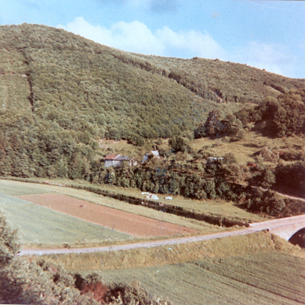
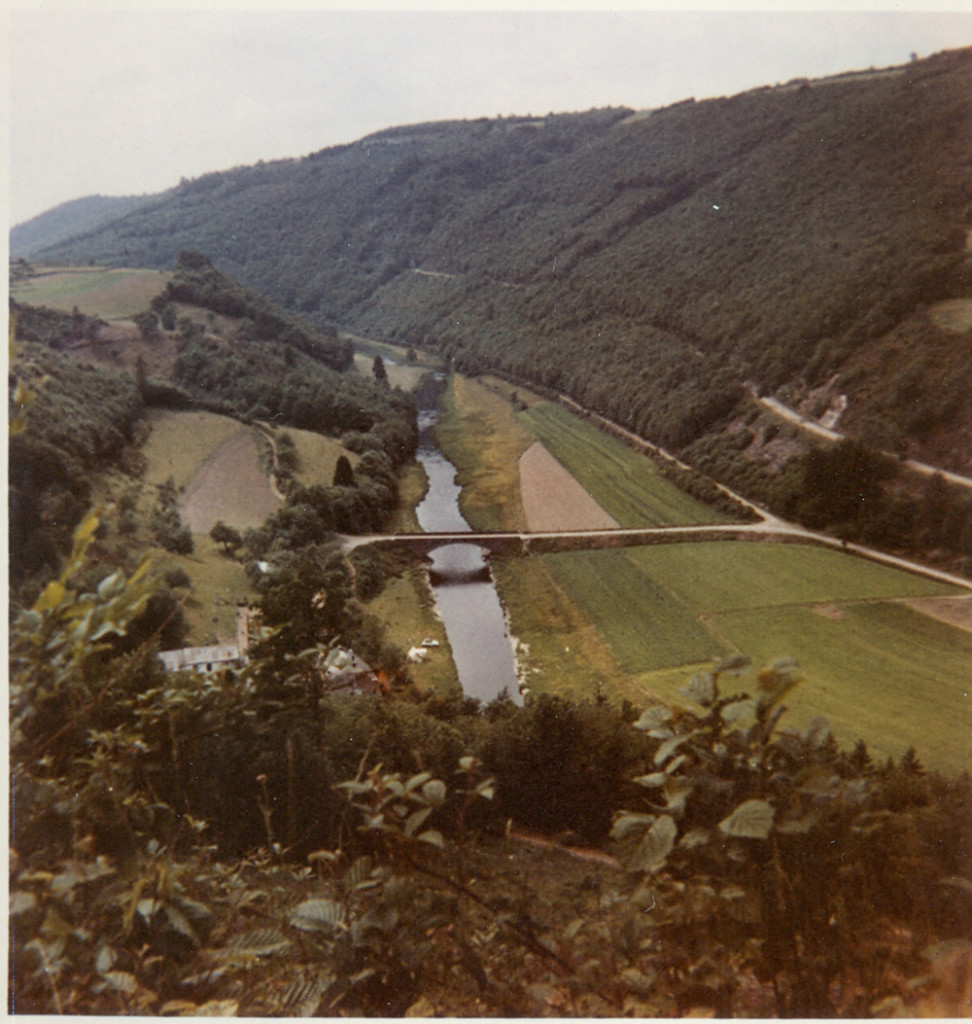
Geographical position
The Tadler mill is situated in the north of the Grand Duchy of Luxembourg in the region called “Oesling”, which lies at an average altitude of 450 m above sea level and forms part of the Ardennes, which stretch from France over Belgium to Germany (Eifel) up to the Rhine. As you drive along the main national road from Ettelbrück (Luxembourg) to Bastogne (Belgium) you turn right in Heiderscheid and after 4 km you arrive in the small village of Tadler lying on a sloping hillside south of the Upper Sûre valley. After a further kilometer’s drive you reach “Pfaffental” (Lux.”Pafendall”), the narrow valley of the Tadler mill. We may assume that the name “Pfaffental” originates from a monastery that owned the grounds in this valley (German”Pfaffe”, Lux. “Paf”=priest,parson); most probably it was St Maximin Abbey from Trier as they owned large properties on Luxembourgish territory. The millwheel was powered by the water of the Tadler stream.
The Tadler stream
Not far from the ridgeway Heiderscheid – Kehmen – Bourscheid, in “Gloetter”, at an altitude of 465m, there is the source of a brook, called “Aaleschbaach” or “Toodlerbaach”(Lux.Baach =brook). On its course down the steep hill into the valley it collects the waters from a source in “Bierbösch” and from two further brooks in the wooded slopes of “Fréinbierg” and “Roudewäldchen”. The water flows down for about 2 km to the Tadler mill and then opens out into the river Sûre. On this short 2km-route the water falls by 211 m, which is an exceptional average fall of 10.55 m per one hundred meters. Such a fall engenders a great power with little water on an overshot waterwheel, but in the summer months the water was too scarce to drive the millwheels. For this reason a large pond was installed in the upper grounds of the mill, where in the night the water was stored to enable a few hours’ corn grinding during the day.


The mill in the land registry of empress Maria-Theresa in 1766
There are no official documents as to when exactly the Tadler mill was founded. However, there exist two land register records concerning a Mathias EILEIDEN, who was recorded as miller at the Tadler mill and his property was itemized in detail. The total surface of the registered land amounted to 2 ha 58 a 59 qm. The biggest part of this land was barren and yielded a mere pittance. The income was ‘too little to survive and too much to starve’. The estimated income amounted to a sum for which one could get about 3 or 4 cartloads of hay. We may assume that the income from corn grinding helped the owner and his family to keep their heads above water.
A momentous marriage in 1809
In 1809 Jean-Pierre LOESCH, born in Tadler in1786, married Catherine SCHMIT, born in 1775, daughter of the miller from the Tadler mill. The bride’s parents had acquired the mill in 1766. The miller died in 1809 and his widow carried on with the mill business. With this marriage a family was founded whose descendants have lived and worked on the farm and the mill in direct line for 8 generations.
The mill in the land registry of 1824
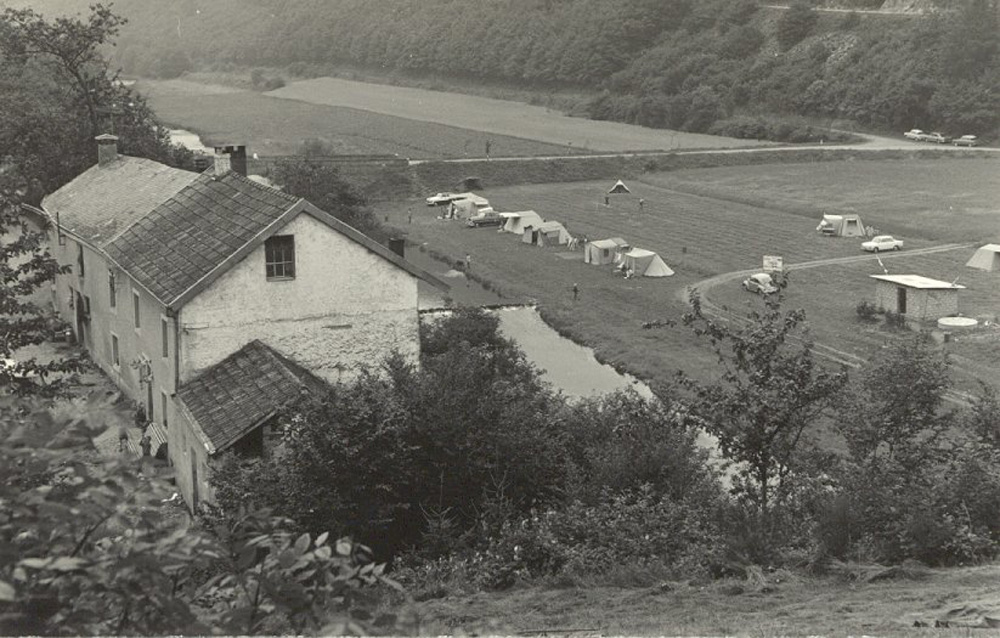
The old plans and documents of the land registry of 1824 offer concrete evidence of the existence of the Tadler mill. It was registered under Section A Nr 3 of the Heiderscheid local government giving the name of the owner, Jean-Pierre LOESCH, and his occupation as “meunier”(=miller). The area was recorded as “Pfaffental”. According to the registry plans the building was 21 m long and somewhat more than 6 m wide. It was divided up into stables, house and mill. The barn was on the opposite side of the road. In the upper grounds there was a relatively large pond, which provided water in times of periodic water shortage from the stream. We may assume that the waterwheel was fixed to the gable of the mill, but there is no evidence to testify what the mill and its interior equipment looked like. Moreover, the later land registers of 1845 no longer recorded the building as a mill. The overshot millwheel probably had a diameter of 4 to 5 meters. It was fixed at cellar height and power was transmitted to the millstones by the brake wheel and the lantern wheel. Whether there existed a grain cleaning or sieving system is doubtful. The mill was – as many others in those days – a rather primitive installation, which eventually fell prey to the economic evolution. Between 1850 and 1860 production stopped and in the course of years the waterwheel and the interior equipment fell into ruin. So far, no trace is left of any of the mill’s equipment, not even a trace of the millstones. This small mill, unfavourably situated in a deep valley, with impracticable roads at the time and shortage of water in the summer, could not keep pace with the competition and the technical improvement of neighbouring mills.

The Keiser family at the Tadler mill for 150 years
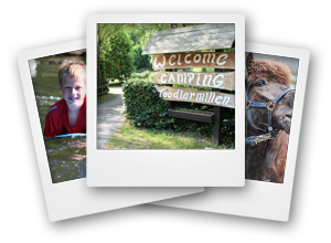
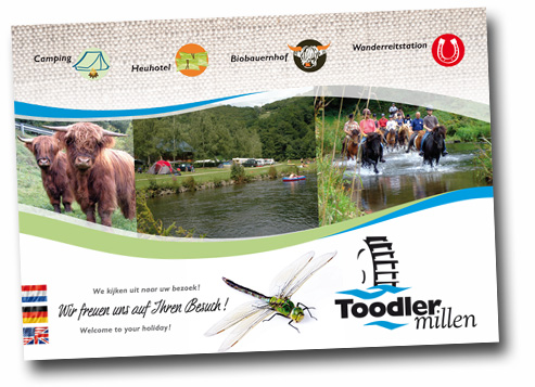
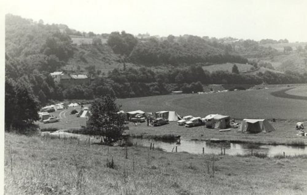
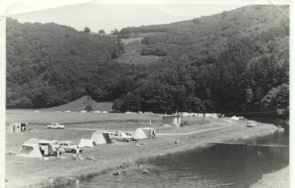
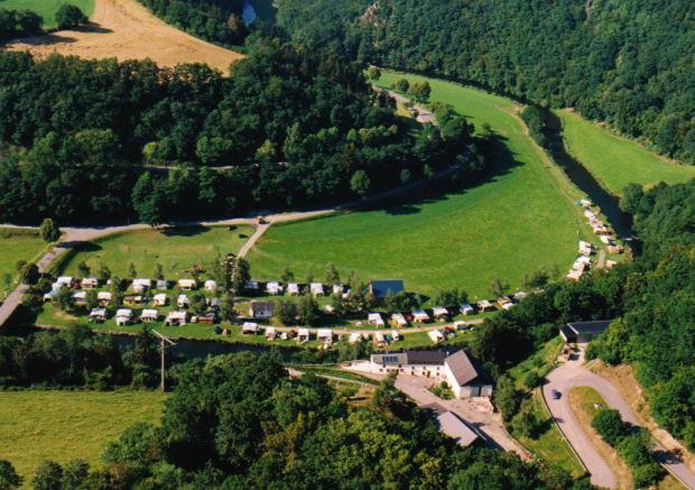
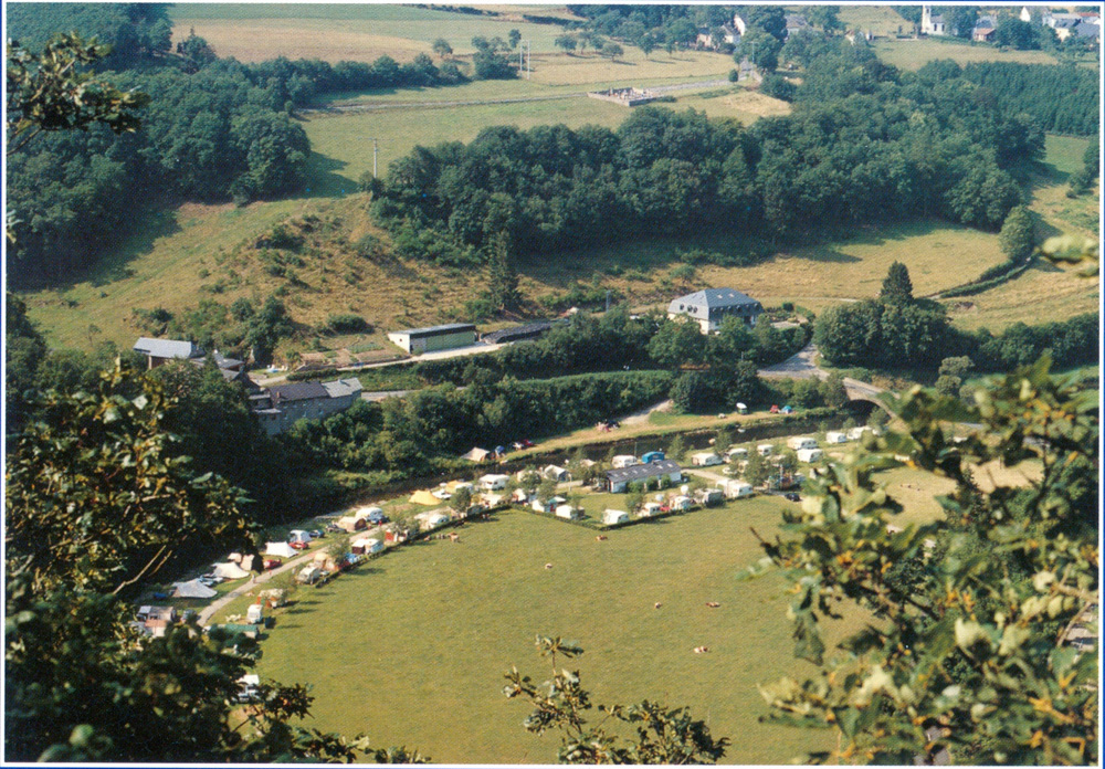
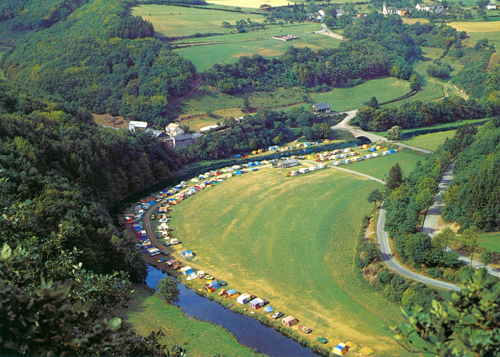
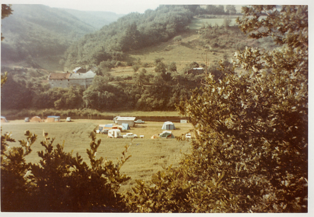
After the corn grinding production of the Tadler mill stopped the family had to rely on agriculture and cattle breeding for survival. In 1860 the family name changed at the Tadler mill. In 1860 the miller’s daughter, Catherine LOESCH, married Reinhard KEISER and since then the name KEISER has been present at the Tadler mill for 150 years from father to son. In 1962 Albert and Anne-Barbe KEISER-JOMMES added to their agricultural activities a new source of income by founding the TOODLER MILL camp-site in the romantic valley along the banks of the river. In 1988 Amand and Sylvia KEISER-BRAUNE took over. They took the important step forward from traditional to biological farming and currently run the camp-site in an ecological and environmentally friendly way.